

MapGuide Open Source Release 2.2
MapGuide Open Source is a platform for developing web mapping applications
Program info
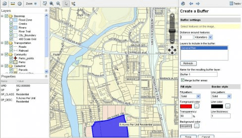
MapGuide Open Source is a web-based platform that enables users to develop and deploy web mapping applications and geospatial web services. MapGuide features an interactive viewer that includes support for feature selection, property inspection, map tips, and operations such as buffer, select within, and measure. MapGuide includes an XML database for managing content, and supports most popular geospatial file formats, databases, and standards. MapGuide can be deployed on Linux or Windows, supports Apache and IIS web servers, and offers extensive PHP, .NET, Java, and JavaScript APIs for application development. MapGuide Open Source is licensed under the LGPL.
Details
Extensions

No information available
The data will be available later.Old versions

No information available
The data will be available later.


Comments